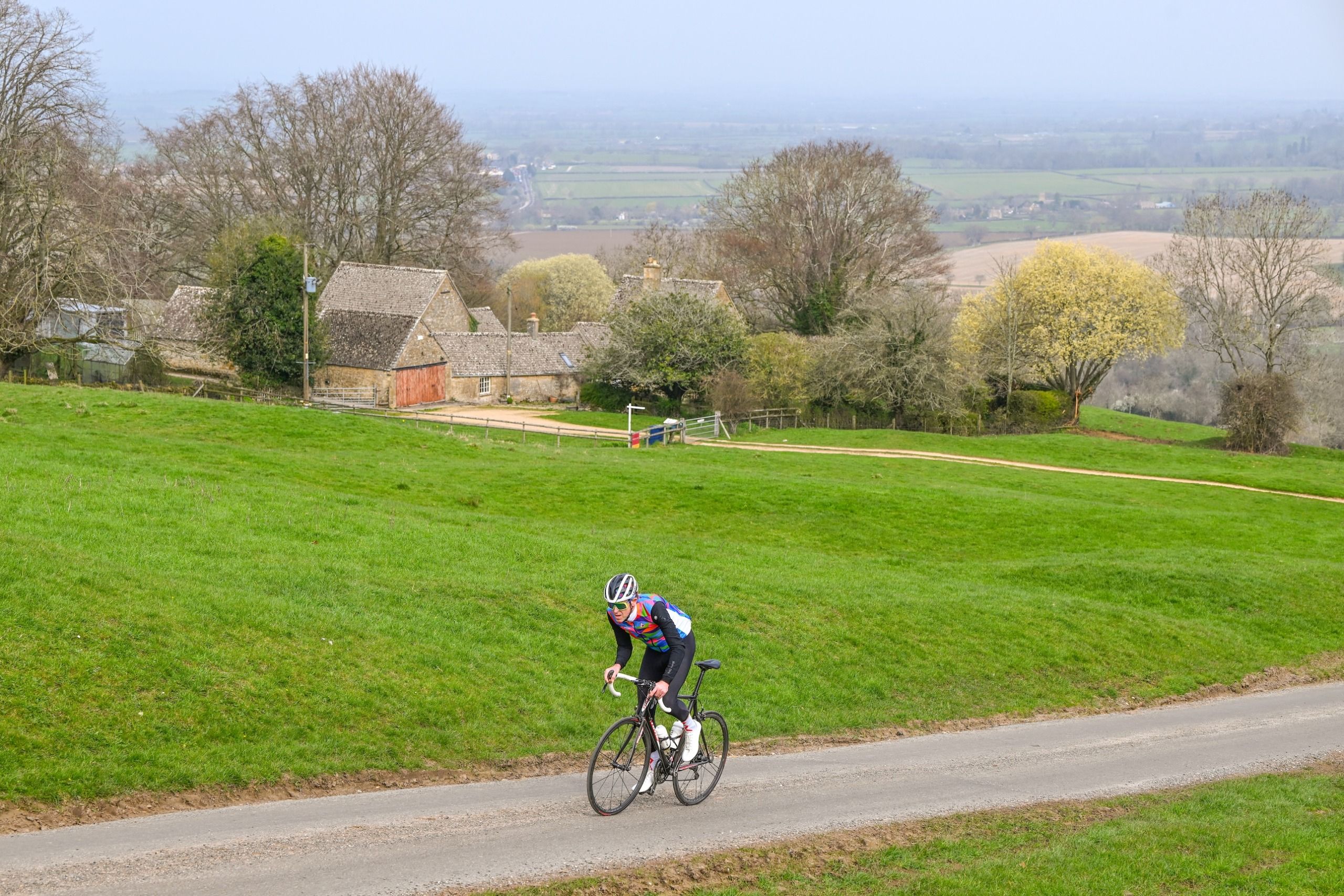
The Cotswolds are packed with some of the UK’s best cycling climbs. Here, we provide two routes, one of 98km and one of 123km, that tackle 10 of the toughest
Ah, the Cotswolds. This enchanting region in south-west and south-central England – spanning five counties, but centred on Gloucestershire and Oxfordshire – is the picture of quintessential English countryside. The pretty villages with their honey-hued stone cottages attract visitors from across the globe. You’ll see them wandering the winding lanes, wondering at the manicured perfection. But we’re not here to marvel at rustic 17th-century architecture; we’re here to sample what lies beneath the beautiful facade. Yes, we’re here to punish our legs on the vicious climbs formed by the Jurassic limestone that is the bedrock of this open-air theme park of English country living.
Beneath the serene beauty lies a landscape of bemusing ascents, from short, sharp gradients to rolling hills – a mixture to punish even the fittest legs. We have plotted two routes to tick off 10 of the best climbs, while taking in plenty more that lie between them. Both routes are packed with elevation, horrendous gradients and, of course, stunning scenery. Starting and finishing in Cheltenham, the shorter ride loops north, while the longer one heads south. Carb up, clip in, and brace yourselves!
More from this series: Read about the best climbs in North Wales.
Distance: 123km (76.4 miles) Elevation: 2,233m (7,326ft)
Heading south from Cheltenham, this route allows you the luxury of 10 sedate kilometres skirting the outskirts of Gloucester before snaking up the first climb of the day, Painswick Road. A real slog of an ascent, it takes you past Coppers Hill through Upton Wood. Descending the narrow slopes of Portway, all that hard-fought elevation is lost in an instant. After another brief period on the flat, you arrive in the village of Haresfield, where the tranquillity is shattered. From here, all hell awaits your legs.

Up next is Haresfield Beacon, a long climb with a few wicked little ramps along the way. Continuing south after dropping down the quiet back roads to avoid Stroud, you cross the Stroudwater Navigation and head onto Frocester Hill. Boasting, without doubt, some of the best views in the area – it’s worth cautiously glancing back over your shoulder as you climb – Frocester Hill is set on a steady-ish and manageable gradient. The road that follows could not be more different in character. Turning left in Uley, you plunge into a gully, then exit via the twisting, narrow and permanently dirty, steep slopes of Owlpen Hill. This gnarly, lurking ramp, which lies hidden in the woods, just gets worse as it rises up to the final 25% ramp through a deep canyon of soil banks. By the time you reach the top, you’ll be breathing out of your ears.
There’s no rest, though, as from here the route resembles the upturned teeth of a saw blade, ramping up and down relentlessly and without pause for a solid 50km. Dropping into Dursley, you arrive at the base of The Broadway, a short, 20% ramp that propels you from the centre of the small town through Cockshoot Wood over 764 lung-busting metres. A brief recovery is afforded as you loop back into Dursley – an excellent place for a pit stop, should you need it – and, once refreshed, it’s time to head back north in the direction of Stroud for a date with the wonderfully scenic, perfectly formed Bear Hill. Next up comes The W – no prizes for guessing which letter it resembles. Caution is advised here, as this is a busy road. Watch out for traffic if you’re chasing the KOM.

The quick succession of hard climbs is by now weighing heavily on your legs, and there are still a couple more killers to come. After a brief rest as you cross Aston Down and the River Frome, your penultimate foe is the climb of Oakridge Lynch, up through the village of the same name. Will this be the gallows for your legs, or will you have enough in the tank for the finale? There is no choice from here but to ride through the centre of Stroud – where, with 25km to go, you could take the opportunity to refill your bottles or grab some more carbs.
Next up is the monstrous Knapp Lane, after which you turn off the B4070 and twist up through the Elliott Nature Reserve on the narrowest of roads of the day, with some horrible stretches of blue 20% gradient. Reward awaits – once at the top, it’s job done, climbing-wise. Now you can sit back, relax in the scenery and complete the loop as you return along the top of the ridge via Birdlip and Leckhampton into Cheltenham.

Distance: 98km (60.9 miles) Elevation: 1,667m (5,469ft)
Heading north from our base in Cheltenham, this ride makes a beeline for Bishop’s Cleeve and almost straight onto the toughest climb of the day. But as a warm-up before you hit the 30% ramps of Bushcombe Lane, we’ve thrown in the 25% slopes of Gambles Lane. From here, you drop straight back into town to ready yourself for the perils that await. Bushcombe Lane ramps up and up until it reaches the magical 30% around its 90° left-hand bend. If you make it around, you’ll make it to the top.
From the summit, the route heads north through Winchcombe and Broadway, allowing you some 20km to recover from the early shock. Next up is Saintbury Hill immediately followed by Dover’s Hill – both famous hill-climb courses. After those, it’s time for a pit stop at the wonderful village of Chipping Campden. Composure regained, the route climbs gradually up Broadway Hill, then continues south via Taddington, Didbrook and Hailes to reach the base of Salter’s Lane. From here, it’s a meander south through Brockhampton, Syreford and Whittington, before arriving back into the outskirts of Cheltenham. Aggs Hill provides one final evil challenge.
More from this series: Read about the best climbs in the North York Moors.

Where to stay
Cheltenham is the base for both rides, as it’s central to our routes, and has excellent transport links, as well as a multitude of accommodation and eating options.
Accommodation
Cheltenham is a large town with several central hotels. If you prefer something quieter, there is a plethora of B&Bs and smaller lodgings available on the outskirts. Airbnb and booking.com should have you covered.
Food and drink
From takeaways to fine dining to well-known franchises and even the famous Ivy restaurant, Cheltenham has it all. As ever, check the local listings and book ahead to avoid disappointment.
What else to see and do
The Cotswolds are home to some of the most famous villages and towns in the world. Check out Bourton-on-the-Water, famous for the River Windrush, which flows through its centre. There is also Castle Combe, known for its honey-coloured houses, and Stow-on-the-Wold, with its market square and antique shops. And don’t forget Bibury, often listed as the most beautiful village in England.
1. THE BROADWAY
Segment: strava.com/segments/19437098
KOM: Adrian Whitwell, 2.17
QOM: Illi Gardner, 3.58
Length: 764m
Elevation: 113m
Average gradient: 14%
Max gradient: 20%
This vicious little road takes you out of Dursley up through Cockshoot Wood to the plateau at the summit. It will have you rapidly clicking down through the gears – and it hits 20% in places.
2. OWLPEN HILL
Segment: strava.com/segments/19437088
KOM: Andrew Feather, 4.16
QOM: Illi Gardner, 5.59
Length: 1,466m
Elevation: 131m
Average gradient: 8%
Max gradient: 25%
Owlpen Hill is well hidden in the dirty, twisting farm roads east of Uley but you’ll know you’ve found it when you see the fear-inducing one-in-four sign.
3. FROCESTER HILL
Segment: strava.com/segments/16290476
KOM: Ed Laverack, 7.19
QOM: Nicole Coates, 9.47
Length: 3,102m
Elevation: 191m
Average gradient: 6%
Max gradient: 11%
A sumptuous, sweeping road set on a gradient that’s just enough to test the legs but without really punishing them. There are stunning views out over your right shoulder almost all the way up.
4. THE W
Segment: strava.com/segments/18210334
KOM: Andrew Feather, 3.11
QOM: Illi Gardner, 4.13
Length: 1,198m
Elevation: 115m
Average gradient: 9%
Max gradient: 13%
The W is so named because its rapid succession of four hairpins form the letter W. This road is a riot to ride while imagining you’re beating Pogačar up a grand Alpine pass.
5. BEAR HILL
Segment: strava.com/segments/668739
KOM: Andrew Feather, 3.54
QOM: Illi Gardner, 5.42
Length: 1,344m
Elevation: 135m
Average gradient: 9%
Max gradient: 18%
Bear Hill is a peach of a road, a near perfect climb on the southern edge of Stroud. Set at the base of a grass-walled amphitheatre, it curves its way to the Black Bear pub at the summit.
6. HARESFIELD BEACON
Segment: strava.com/segments/6913771
KOM: Andrew Feather, 6.19
QOM: Illi Gardner, 8.21
Length: 2,260m
Elevation: 193m
Average gradient: 8%
Max gradient: 18%
With stretches of 20%, this long climb ebbs and flows as it drags you out of the village of Haresfield and onto the top of the ridge. After a mini recovery, it ramps up again into a final nasty kicker.
7. KNAPP LANE
Segment: strava.com/segments/29138696
KOM: Andrew Feather, 7.31
QOM: Illi Gardner, 10.16
Length: 2,485m
Elevation: 180m
Average gradient: 7%
Max gradient: 21%
A rollercoaster of a climb that hits you with surprise after surprise as it snakes westward through idyllic Cotswold crossing cattle grids and heads up some brutally steep slopes.
8. DOVER’S HILL
Segment: strava.com/segments/8459161
KOM: Andrew Feather, 4.43
QOM: Izzy Rodriguez, 6.00
Length: 1,733m
Elevation: 139m
Average gradient: 10%
Max gradient: 14%
This famous hill-climb has been the venue for numerous National Championships. Its double-digit average gradient pushes you hard all the way to the summit.
9. SALTER’S LANE
Segment: strava.com/segments/3844695
KOM: Beast Mode Barbie, 6.39
QOM: Naomi de Pennington, 9.08
Length: 2,294m
Elevation: 188m
Average gradient: 8%
Max gradient: 14%
This Peak District-like climb starts ordinarily enough, but once free of the early tree cover, crosses open grassland on a neat narrow strip of tarmac on a steady 10% slope.
10. BUSHCOMBE LANE
Segment: strava.com/segments/16290484
KOM: Dave Roper, 4.50
QOM: Illi Gardner, 5.41
Length: 1,332m
Elevation: 156m
Average gradient: 12%
Max gradient: 30%
No trip to the Cotswolds is complete without a visit to Bushcombe Lane. This 10/10 killer touches 30% towards the top and will have you begging for mercy around its final left-hand bend.
This article was first published in the 23 April 2026 print edition of Cycling Weekly magazine – available to buy on the newsstand every Thursday (UK only) while digital versions are available on Apple News and Readly. Subscriptions through Magazine's Direct.